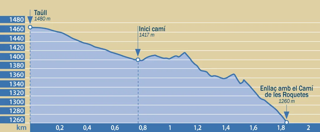
From Taüll (1,480 m), head down the Boí road to the first bend, then turn right onto the old Llanceros Path. The trail starts off flat before gently descending and joining the Les Roquetes Path. Turning left will take you to Boí (1,265 m – 15 minutes), while turning right will lead you upwards towards Caldes de Boí (1,472 m – 2 hours).


From Taüll (1,480 m), head down the Boí road to the first bend, then turn right onto the old Llanceros Path. The trail starts off flat before gently descending and joining the Les Roquetes Path. Turning left will take you to Boí (1,265 m – 15 minutes), while turning right will lead you upwards towards Caldes de Boí (1,472 m – 2 hours).